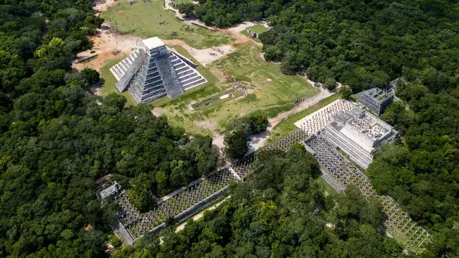
Satellites Unveil Hidden Mayan Ruins Amid Dense Forests
Satellites are revolutionizing the discovery of ancient Mayan ruins, overcoming the dense forests that have long concealed these historical treasures.
“Archaeologists have mapped more Mayan sites, buildings, and features in the past 10 years than in the previous 150 years,” said Brett Houk, an archaeology professor at Texas Tech University, during a NASA-led space archaeology conference on September 18, as reported by Space.com.
This rapid progress is attributed to advanced satellite technology, particularly the use of lidar (light detection and ranging). This pulsed laser technique allows satellites to penetrate the thick canopy covering typical Mayan sites, Houk explained at the two-day NASA and Archaeology From Space symposium, which was livestreamed.
The Maya, indigenous to modern-day Mexico, Guatemala, and northern Belize, were the dominant regional group before the Spanish invasion in the 16th century. They are renowned for their large pyramids, stone structures, agricultural management, and written records.
While famous sites like Chichén Itzá in Mexico are recognized as significant world heritage sites by UNESCO, many other Mayan zones remain unexcavated and unknown to modern society, hidden beneath the forest that reclaimed them after abandonment.
Houk hinted at “new lidar missions” — currently under embargo as the team finalizes peer-reviewed publications — that are aiding his team, co-led by Amy Thompson from the University of Texas. These satellites are helping scientists uncover more ruins across a permitted area in northeastern Belize.
The survey spans a region about 10 times the size of Manhattan, covering 250 square miles (650 square kilometers) rich in ruins. The team discovered 28 additional monumental sites “in just a couple of days in the lab, staring at the data,” according to Houk. They plan to follow up with excavations, including a summer project focused on canal and water management in the region. Mayan society was influenced not only by Spanish pressure but also by ongoing climate change, as numerous studies suggest. Given today’s pressing issue of human-induced global warming, examining Mayan technology may offer valuable insights.
“People and communities adapted to changing environmental conditions and rainfall, designing what appears to be a resilient mosaic of land use,” said Tim Murtha from the University of North Carolina at Charlotte, discussing his team’s independent space study of Mayan technology. Examples include corn-growing terraces and water catchments for drought conditions.
Small satellites offer more opportunities for examining Earth’s surface, as they fly closer to our planet, requiring less fuel and money. Consequently, flyovers, or “revisits,” are more frequent with smaller cubesats than with larger satellites at higher altitudes.
Other conference presenters acknowledged companies like Planet Labs for providing valuable Earth observations for archaeology. However, cost and access remain challenges; scientists often rely on open data or declassified satellite imagery, as satellite companies also aim to profit.
Artificial intelligence could eventually help identify ruins in satellite images, but training and accessing the necessary algorithms are costly challenges. Presenters called for more education and accessibility to support future archaeological investigations.
Source: Space.com


