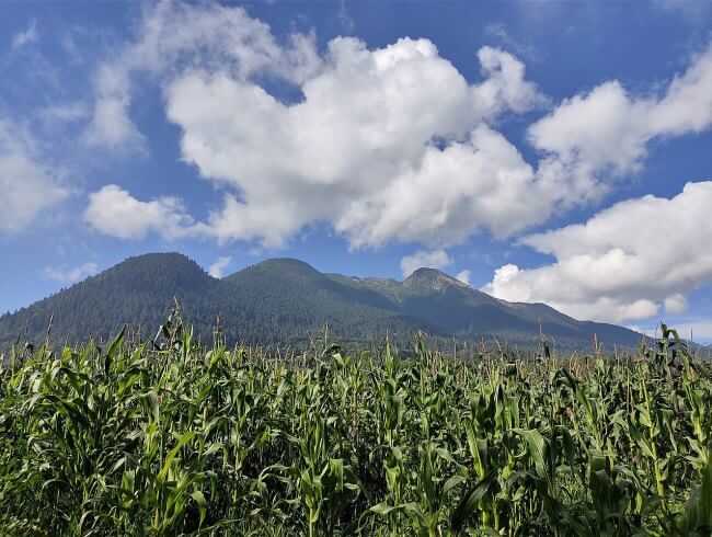
The Mexican capital is surrounded by large volcanoes and hills accompanied by beautiful forest areas. To the south we have the famous Cumbres del Ajusco National Park, an area with privileged nature and one of the few places in the capital where snow falls during the winter season. Here we tell you about the history of Ajusco, one of the beautiful forests we have in Mexico City.
History of Ajusco, one of the forests of Mexico City
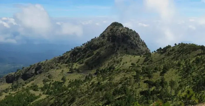
In Ajusco we will find incredible landscapes./Image Wikipedia
This forest located in a mountainous area is one of the ideal places to clear your head, live with nature and breathe fresh air. In Ajusco we have the La Cruz del Marqués hill, which is the highest elevation in the Mexican capital with a height of 3,930 meters above sea level and also has three other main elevations. The forests in the area are famous for being home to several endemic creatures that are occasionally seen by visitors.
The Ajusco is an extinct volcano and is older than the Popocatépetl. Its National Park is a reference for visitors from Mexico and other parts of the world and its forests invite you to do different activities that range from picnics and hiking, to mountaineering for beginners and experts. On clear days we can see its peaks from the city.
The Cumbres del Ajusco National Park
On September 23, 1936, the area that includes the Ajusco with its four large elevations and its forests was declared a National Park by the then president Lázaro Cárdenas. Although this natural area has been threatened by urban growth, it remains one of the most important forested areas of Mexico City, located in the Tlalpan municipality and part of Magdalena Contreras.
In addition to La Cruz del Marqués hill, the famous Pico del Águila or Cuauhtépetl is also located in the area. It is considered the second highest peak in the Mexican capital and offers spectacular views of the Valley of Mexico. This hill bears its name because, seen from an angle, it has the shape of an eagle in flight. Among its high elevations are also Pico Santo Tomás and Cerro Mezontepec.
Ajusco is one of the largest forests in the city, along with the Desierto de los Leones National Park, the Tlalpan Forest and the Chapultepec Forest. It is characterized by the large number of pines, oaks and firs that inhabit it, as well as its extensive mountain pastures and is home to around 520 species of plants and animals. This forest invites adventure with its hills, its immense trees and its incredible landscapes.
Pre-Hispanic and Colonial Ajusco
The Cumbres del Ajusco National Park, with its 920-hectare extension, is within the Ajusco – Chichinauhtzin Mountains, which also includes the State of Mexico and Morelos. The word Ajusco means “where water blooms” in Nahuatl and the original word that gave it its name was “axochco”, composed of “atl” (water) and “xochitl” (to sprout or bloom).
This place where snow generally falls in winter became a sacred place for the ancient Mexican peoples. In pre-Hispanic times, this region was occupied by Tepanec groups who fought against the Mexicas and retreated to the area after being defeated. In 1970, a sculpture representing Tlaloc was found on the high peaks of the place.
Within the forest we have the base of the Tequipá pyramid, which remains hidden under vegetation, since its archaeological zone has not been widely explored. It is a ceremonial center built by the Tepanecs in the 14th century. Offerings and ceramic pieces were found there, and at the top there was a stone in the shape of a chest that today remains as a relic in the atrium of the church of Santo Tomás and is known as “El Cuartillo.”
Continuing with its history, Santo Tomás de Ajusco was founded with the conquest in 1531. It is the first colonial town, dedicated to evangelizing the indigenous inhabitants of the region. Later, San Miguel Ajusco was founded, as well as haciendas such as El Arenal, Mipulco and Xoco. Activities such as agriculture, logging and quarrying were developed in the area.
A walk through Ajusco
Ajusco is a place full of history and there is no shortage of restaurants and places to stay. If you like outdoor activities, don’t miss a good walk through the forests of this National Park, which has unique trails with charming waterfalls. If you like mountaineering, climb Pico del Águila to enjoy an incredible landscape.
To get to Cubres del Ajusco National Park you can take the Picacho – Ajusco highway, which begins at the junction of Periférico Sur and Bulevar de la Luz or follow the route that goes from the detour to the Cuernavaca exit in Tlalpan, at km 25 of the free highway to Cuernavaca is the detour to Ajusco via San Miguel Xicalco.
Source: sopitas


