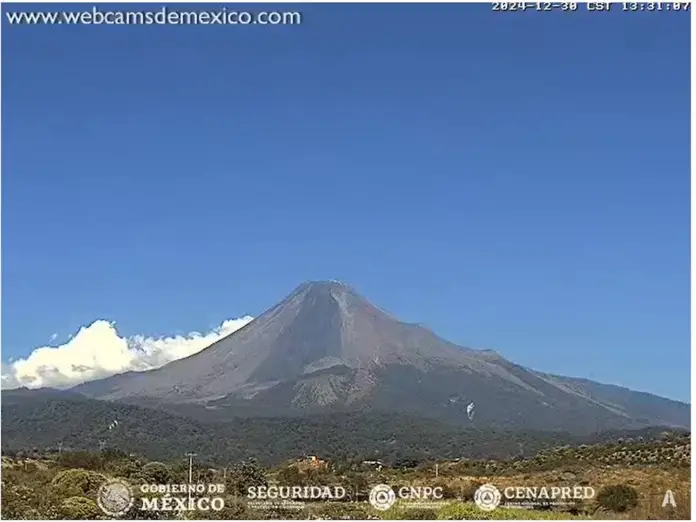
The danger traffic light for the Volcano of Fire in Colima remains on alert for passive degassing due to the possibility of ash falling in the surroundings of the colossus. The administration of the National Meteorological Service (SMN) keeps the volcano under constant surveillance to promptly notify changes in activity.
Weather forecast in the area of the volcano
Mostly clear sky, with visibility towards the area of the volcano, which would facilitate observation in the event of an exhalation of water vapor, gas and/or ash, (Image 1). The volcano is in the passive degassing stage.
Manzanillo Colima Atmospheric Radiosonde, 06:00 am local time, December 30, 2024: At 5000 m: South-southeast wind of 18.9 km/h. Between 5000 and 7000 m: East-southeast wind 26.7 km/h. Above 7000 m: South-southeast wind 19.6 km/h.
There is no cloud cover over the volcano area, so satellite detection would be possible in case of any activity (Image 2). The satellite estimate of rainfall does not show accumulated precipitation in the volcano area in the last three hours, this with a cutoff at 12:00 h today, local time (Image 3).
Ash trajectory
In the event of any exhalation of volcanic ash, gas and/or water vapor, the trajectory forecast of the Hysplit (Hybrid Single-Particle Lagrangian Integrated Trajectory) model, executed at CONAGUA-CGSMN with a possible emission height of 500 meters above the volcanic cone which is 3,839 meters AMSL “above mean sea level” (2,745 meters AGL “above ground level”), indicates trajectories to the northwest (simulating exhalation every next hour, 6), as it passes through the northeast area of the state of Colima and the south, center-southwest and center-west areas of the state of Jalisco, for the first 12 hours of the forecast, (14:00 to 22:00 local time of the following day). Subsequently, for the last 12 hours of forecast (02:00 to 14:00 local time of the following day), the trajectories will continue over the central-southwest, central-west, west and west-northwest areas of the state of Jalisco; the southwest area of the state of Nayarit and over the Pacific Ocean. These trajectories predict the main direction of emissions of the plume of gas, water vapor and/or volcanic ash, coming from the Volcano of Fire of Colima.
Beyond a dangerous volcano
The Volcano Nevado de Colima National Park, opened on September 5, 1936 by Lázaro Cárdenas, covers 6,554.75 hectares that include the Volcanic Complex of Colima, composed of the Volcano of Fire, one of the most active in Mexico and the Nevado de Colima. Its status as a federal Protected Natural Area highlights its wealth of diverse ecosystems, a result of its volcanic origin, intricate topography, high elevations, mountainous isolation, and proximity to the Pacific Ocean.
The landscape is distinguished by slopes covered with pine and oak trees, in contrast to semitropical areas at lower altitudes, fostering a heterogeneous biodiversity that includes endemic species of flora and fauna. The Colima Volcano, a stratovolcano made up of layers of lava and sedimentary rocks, with geological elements dating from the Jurassic to the Quaternary, provides testimony to the complex geological history of the region.
Although the Colima Volcano is famous for its constant activity, Popocatépetl is considered more dangerous due to nearby communities. The protected status of the National Park allows visitors to enjoy outdoor activities such as hiking, camping, and volcano observation, encouraging the conservation of the area.
This conservation guarantees the well-being of its biodiversity and offers future generations the opportunity to value and study this unique ecosystem, highlighting the importance of protecting these natural spaces.
Source: infobae


