Weather Alert for Campeche, Yucatán, and Quintana Roo
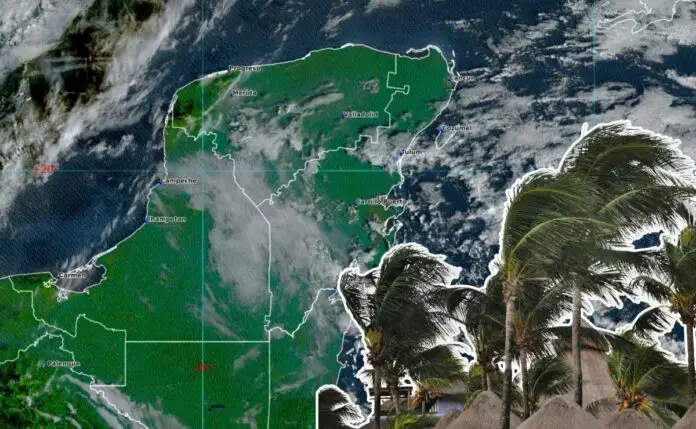
From January 6 to 9, the Yucatán Peninsula will experience strong winds and high waves, according to the National Meteorological Service (SMN). Residents are advised to take precautions as a “Norte” event is expected to impact the region.
Monday’s Forecast
On Monday, cold front 21 will move along the Gulf of Mexico coast, combining with a low-pressure channel over the Yucatán Peninsula and humidity from the Caribbean Sea, resulting in showers and rain. The Arctic air mass associated with the front will cause a “Norte” event, extending towards the Isthmus and Gulf of Tehuantepec, with gusts of 40 to 60 km/h on the coasts of Campeche, Yucatán, and northern Quintana Roo.
Daily Weather Conditions
– Monday: Partly cloudy to cloudy skies, cool and temperate weather in the morning, warm to hot in the afternoon with maximum temperatures of 30 to 35°C. Cloudy skies with rain and showers in Campeche, Yucatán, and Quintana Roo. At night, a “Norte” event with gusts of 40 to 60 km/h.
– Tuesday: Cold front 21 will extend over southeastern Mexico and the Yucatán Peninsula, causing heavy rains in Campeche. The associated cold air mass will maintain the “Norte” event with gusts of 70 to 90 km/h in the Isthmus and Gulf of Tehuantepec, and 50 to 70 km/h on the coasts of Campeche, Yucatán, and Quintana Roo. Showers with heavy rainfall of 25 to 50 mm in Campeche, and isolated rains of 0.1 to 5 mm in Yucatán and Quintana Roo. Waves of 1 to 3 meters high are expected.
– Wednesday: Isolated rains of 0.1 to 5 mm in Quintana Roo, with a “Norte” event of 30 to 50 km/h and gusts of 50 to 60 km/h on the coasts of Campeche, Yucatán, and Quintana Roo. Hot afternoons with maximum temperatures of 30 to 35°C in Campeche.
– Thursday: Winds of 10 to 20 km/h and gusts of 40 to 60 km/h in Campeche, Yucatán, and Quintana Roo. The cold air mass will move towards the Gulf of Mexico, causing a gradual increase in daytime temperatures in the Yucatán Peninsula.
Stay safe and take necessary precautions during this weather event.
Source: Debate


