
After a fairly dry month, the weather is expected to change in the last days of April and early May, due to the interaction of several unstable weather systems, supported by the current relief and heat, triggering heavy rains and storms in at least half of Mexico.
General forecast of a possible “rainy season”
Although the heat will persist in our country this weekend, with typical temperatures of 30 to 45°C, especially in coastal and plain states, models continue to show the incidence of unstable systems starting next Tuesday, April 29, and throughout the first week of May, with significant rainfall.
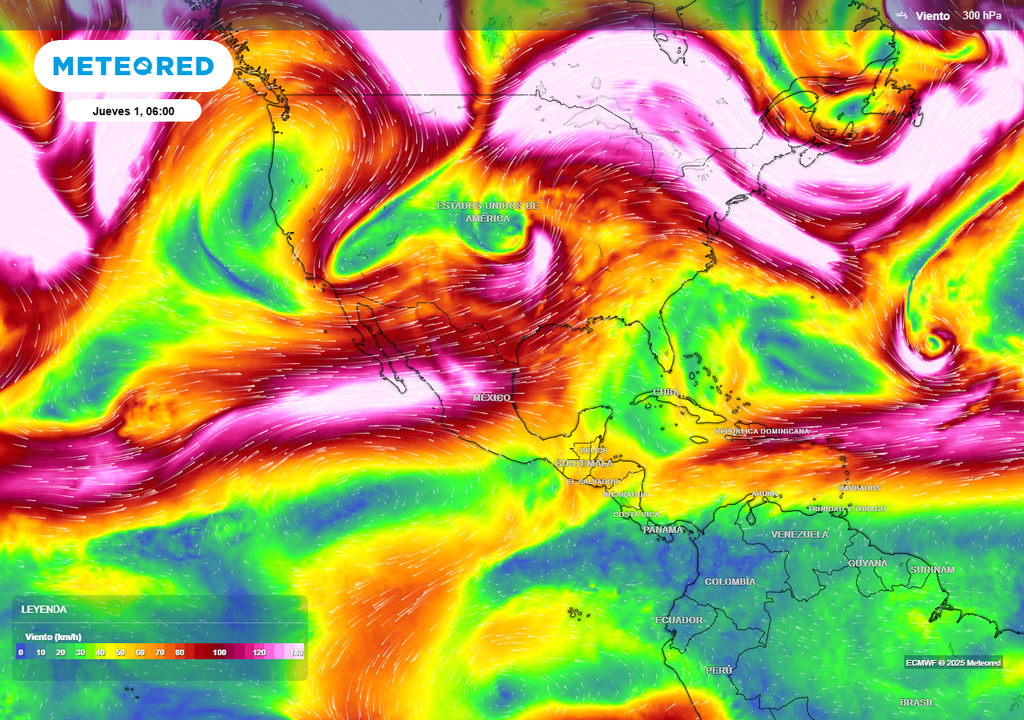
There have been variations in the scenarios over the days, but it is persistently indicated that precipitation would increase significantly and temperatures would stabilize. Next week, before the end of April, a cold vortex will move over northern states, heading toward the United States starting May 1.

If there are no changes, a rainy storm could begin in the central-eastern half of Mexico at the end of next week due to the interaction of several systems, bringing beneficial abundant rains, wind, hail, and a marked drop in temperature.
This system will dissipate and move away from the Mexico high, which had established itself this weekend, clearing the way for cold vortices and/or troughs over the north-central half of Mexico during the first week of May. This will increase instability, which would be supported by the relief and heat, triggering abundant rains.
Atmospheric circulation will change, with cold vortices and polar troughs moving toward Mexico, causing destabilizing conditions with rain and cool temperatures starting next week.
During this period, a cold front is likely to enter the northwest between this Sunday and Monday, but it will be brief and have little impact. Another front could enter at the end of the week, after May 1st, and another after May 5th, the latter two being more impactful; stay tuned for updates.
States with Potential Rainfall
For the period from April 29 to May 6, with rainfall expected to vary daily in extent, intensity, and duration, significant rainfall is forecast for Coahuila, Nuevo León, Tamaulipas, San Luis Potosí, Hidalgo, Puebla, Tlaxcala, the State of Mexico, Mexico City, Morelos, Guerrero, Veracruz, Oaxaca, and Chiapas.
Accumulated rainfall amounts of 10-30 mm and local rainfall amounts of 50-80 mm, with extreme rainfall of 100-200 mm possible in isolated areas of Coahuila, Nuevo León, Tamaulipas, Puebla, Tlaxcala, Veracruz, Oaxaca, Chiapas, San Luis Potosí, and the mountains of the Valley of Mexico. Hailstorms are likely, significant in both quantity and size, with gusty winds and snow on volcanoes.
Accumulated Rainfall Forecast in Millimeters
A rainy season could occur in the northeast, center, east, and parts of the southeast starting next week, benefiting and cooling the environment.
More isolated and with smaller amounts between 5-15 mm, with some exceeding 20 mm, are likely in Chihuahua, Durango, Zacatecas, Jalisco, Aguascalientes, Guanajuato, Querétaro, Michoacán, Tabasco, Campeche, and Yucatán. Some hail and wind gusts are not ruled out. Strong events cannot be ruled out in the southeast due to likely cold fronts.
How likely is it to occur?
We are approaching the period of interest, which is expected to begin next Tuesday and its effects will increase over the days, with a 70-80% chance of occurrence as described. It is important to note that the likelihood of occurrence is increasing, with a 90% chance of occurrence now approaching.

Source: meteored


