

The municipality of Culiacán has 49 flood risk zones in addition to 148 points on roads and 57 in communities susceptible to flooding. Identify the points on a map and take precautions.
Every time a rainy season begins, you should remember the points susceptible to flooding in the municipality and the city of Culiacán. Since 2020, there has been a Hazard and/or Irrigation Atlas System for the municipality of Culiacán, Sinaloa.
During the showers, we recommend that you stay sheltered as much as possible until the rain subsides and the streets are clear, to avoid unfortunate events and ensure the safety of everyone, including household goods.
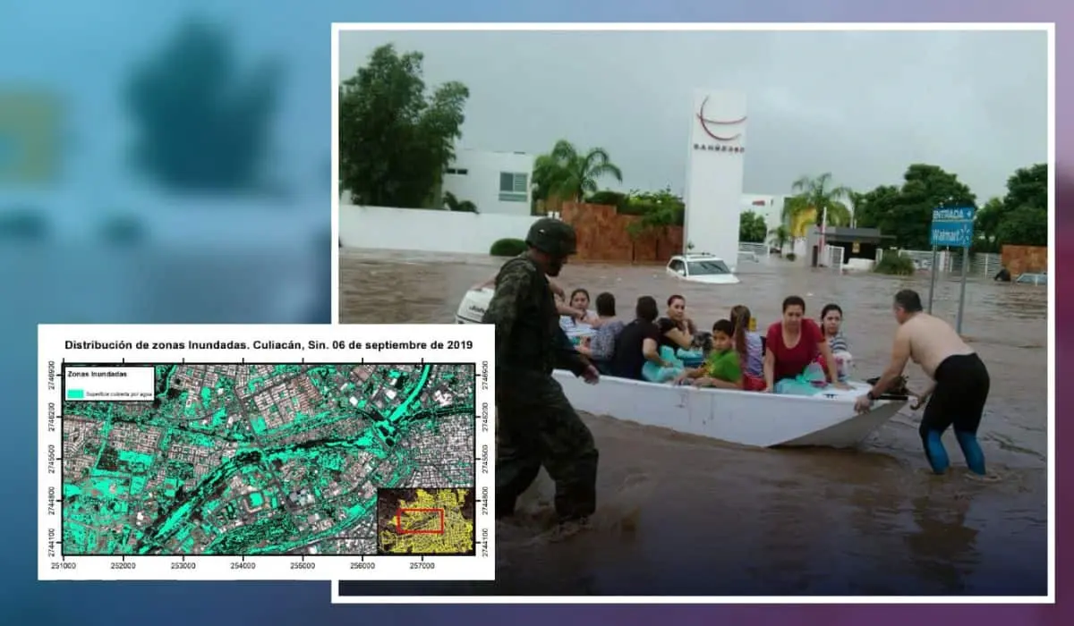
When there are atypical or intense rains in Culiacán, the basins and groundwater tables are fed, causing the rains to concentrate at points of influx. Study the flood site map provided by Mapasin and IMPLAN Culiacán.
According to the Risk Atlas of Culiacán, the areas most susceptible to flooding due to the passage of streams with the most popular neighborhoods are those adjacent to the Humaya River, north of the city, such as Las Cucas, 6 de Enero, Loma de Rodriguera, Jesús Valdez.
Next are the sectors close to the Bacurimí stream: Valle Alto, La Conquista, Espacios Barcelona. Also in the risk zone are Industrial El Palmito, La Isla Musala (by the Tamazula River), La Pemex and Las Quintas on the Malecón side.
The rural communities of Culiacán that are at risk are: Costa Rica, Eldorado, Las Arenitas, Las Piedritas, Las Víboras, El Tamarindo, where in 2018 they suffered severe damage due to storm E-19.
Threshold of hydrometeorological phenomena in Culiacán
In the last 70 years (from 1951 to date), the municipality of Culiacán has been impacted by 50 meteorological systems with the following characteristics:
19 (39%) were tropical storms
12 category 1 hurricanes (25%)
8 tropical depressions (16%)
7 category 2 hurricanes (14%)
2 category 3 hurricanes (4%)
1 category 4 hurricane (2%).
A category 5 hurricane on the Saffir-Simpson scale has never hit the capital.
This figure indicates that 0.7 hydrometeorological systems have hit Culiacán in the last 7 decades. In other words, there is a risk that one will hit at least once a year.
Also, the months in which these phenomena have the greatest impact are at the end of August, September and all of October. Stay informed on the dates when the threshold at which these systems can potentially enter the territory.
Source: tusbuenasnoticias


