
The Colima Volcano, also called the Volcano of Fire of Colima, is monitored incessantly by the National Meteorological Service (SMN). This majestic colossus exhibits signs of activity and there is a possibility that it will manifest events during the rest of the day.
Weather forecast in the volcano area
High cloudy sky, with visibility towards the volcano area, which would facilitate observation in case of water vapor, gas and/or ash exhalation event, (Image. The volcano is in a passive degassing stage.
Virtual Atmospheric Sounding (based on GFS 12Z model) of Manzanillo Colima, 06:00 am local time, February 3, 2025: At 5000 m: North-northwest wind of 10 km/h. Between 5000 and 7000 m: North-northeast wind of 20 km/h. Above 7000 m: Northeast wind of 28 km/h.

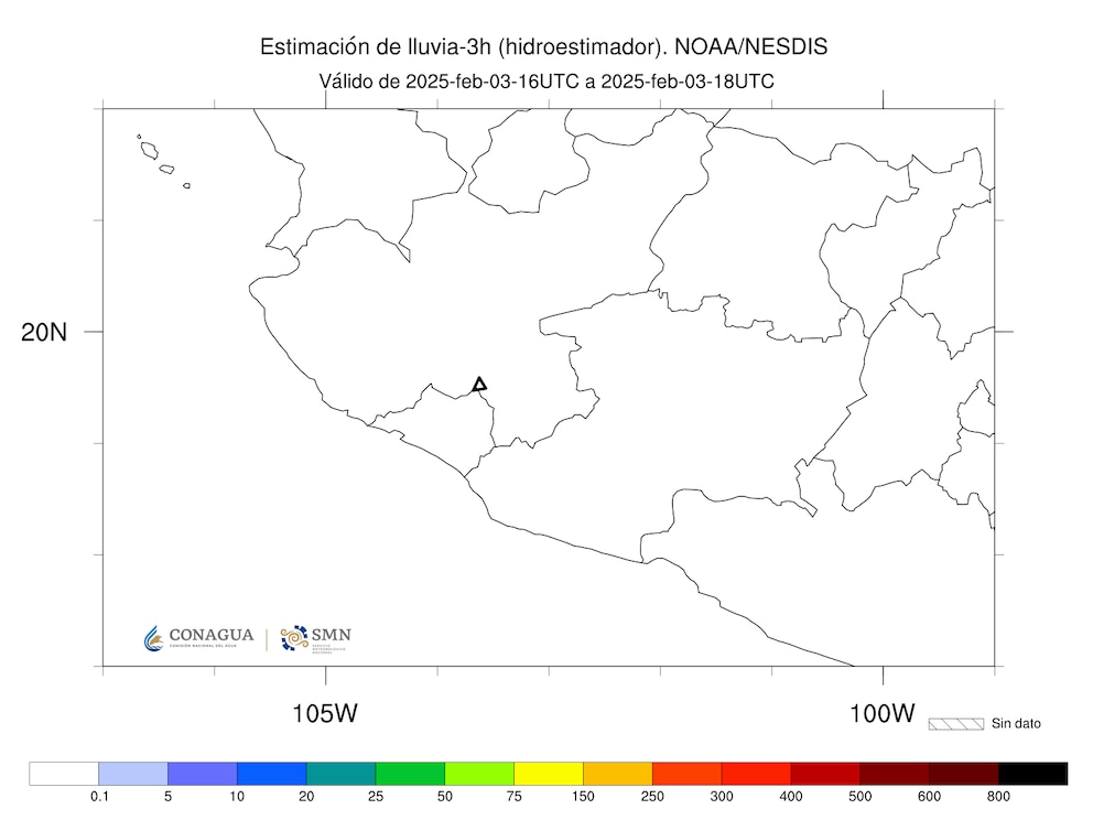
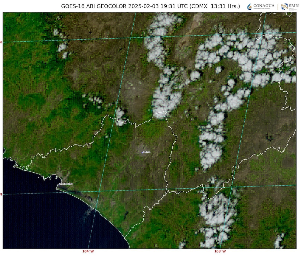
There is cloudiness over the volcano area, which would hinder the detection of volcanic activity by satellite observation, (Image 2). Satellite rainfall estimation There is no accumulated precipitation in the area of the volcano in the last three hours, this with a cutoff at 12:00 h today, local time (Image 3).
Ash trajectory
In case of any exhalation of volcanic ash, gas and/or water vapor, the trajectory forecast of the Hysplit model (Hybrid Single-Particle Lagrangian Integrated Trajectory), executed in CONAGUA-CGSMN with a possible emission height of 500 meters above the volcanic cone that is 3,839 meters AMSL “above mean sea level” (2,745 meters AGL “above ground level”), indicates some trajectories to the west-northwest, west and west-southwest, changing to the northwest (simulating exhalation every next hour, 6), as it passes through the northeast, north and northwest of the state of Colima and the south and south-southwest of the state of Jalisco, for the first 12 hours of the forecast, (14:00 to 02:00 local time the following day). Subsequently, for the last 12 hours of the forecast, (02:00 to 14:00 local time the following day), the trajectories will continue over the south-southwest, central-southwest, central-west and northwest of the state of Jalisco. These trajectories predict the main direction of emissions from the plume of gas, water vapor and/or volcanic ash, coming from the Volcano of Fire of Colima.
The Colima Volcano National Park, located on the border between Jalisco and Colima, is famous both as a federal Protected Natural Area and for its extraordinary Volcanic Complex, which includes the Volcano of Fire and the Nevado de Colima, covering a total of 6,554.75 hectares. This natural space was proclaimed a National Park on September 5, 1936, by President Lázaro Cárdenas and is characterized by its varied landscape that ranges from slopes with pine and oak forests to semitropical areas at its lowest levels, hosting a rich biodiversity that positions it as a valued natural museum of flora and fauna.
The protection regulations for the Nevado de Colima Volcano National Park emphasize its uniqueness, which is due to the diversity of ecosystems and species it houses, a wealth derived from its volcanic origin, the diversity of its relief, the elevation of its peaks, its separation from other mountain ranges and its proximity to the Pacific Ocean; elements that together create a unique habitat.
Although the Colima Volcano is known for its high activity, it is Popocatépetl that is classified as the most dangerous for nearby communities due to its destructive potential. The Colima Volcano is classified as a stratovolcano, composed of alternating layers of hardened lava, with a geological structure formed by Jurassic rocks, Cretaceous limestone, as well as marine sedimentary rocks and granite formations, the latter from the Cretaceous to the Quaternary.
Thanks to its status as a protected area, the park offers the opportunity to engage in recreational activities such as observing the volcano from specific points, camping and hiking, allowing visitors to enjoy its natural surroundings and the beauty of the volcanic landscape.
Source: infobae


