
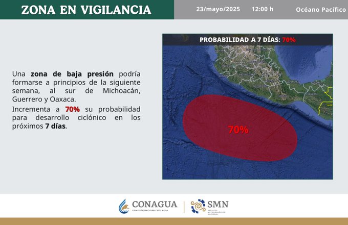
The National Meteorological Service (SMN) reported on May 23 that a low-pressure zone with a 70% probability of cyclonic development is being monitored off the southern coasts of Michoacán, Guerrero, and Oaxaca for the next seven days.
The formation could originate early next week and generate adverse conditions on land and at sea.
States under watch for heavy and intense rains
This Thursday’s forecast warns of intense rains in Oaxaca and Chiapas, as well as very heavy rains in Michoacán and Guerrero, all accompanied by lightning, possible hail, and even landslides and flooding.

Heavy rains are also expected in:
San Luis Potosí
Jalisco
State of Mexico
Mexico City
Morelos
Puebla
Tlaxcala
Hidalgo
Veracruz (south)
With showers in:
Chihuahua
Coahuila
Nuevo León
Durango
Zacatecas
Aguascalientes
Colima
Guanajuato
Querétaro
Tamaulipas
Tabasco
Campeche
Yucatán
Quintana Roo
And scattered showers in Nayarit.
Recommendations
Authorities urge the public to stay informed through official channels and take precautions for possible flooding, rising rivers, landslides, and high temperatures. They also urge people not to be overconfident if the sky remains clear, as rains can be sudden and torrential.
It’s worth remembering that the Pacific hurricane season officially began on May 15, a period during which the risks of heavy rains, tropical storms, flooding, and other associated meteorological phenomena increase in the Mexican states located in that region.
Source: unotv


