
The National Meteorological Service (SMN) of the National Water Commission (Conagua) Warned of Intense Storms Across Much of Mexico
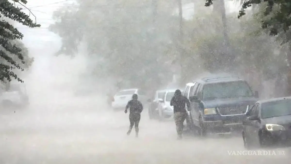
A Black Storm is approaching Mexican territory, bringing 48 hours of intense rainfall, strong winds, thunderstorms, and hail, according to the weather forecast from the National Meteorological Service (SMN) of the National Water Commission (Conagua).
For this Monday, the Mexican monsoon and atmospheric instability over the northwest of the country will cause intense rainfall in areas of Baja California Sur, Sonora, Sinaloa, and Chihuahua; very heavy rainfall in areas of Durango; and heavy rainfall in areas of Baja California, accompanied by lightning and strong wind gusts.
Meanwhile, a cyclonic circulation and troughs in the middle and upper levels of the atmosphere over the interior of the country, atmospheric instability, and a low-pressure channel over southeastern Mexico, along with a new tropical wave 37 approaching the Yucatán Peninsula, will generate very heavy rainfall in areas of Zacatecas, Aguascalientes, San Luis Potosí, Nayarit, Jalisco, Colima, Michoacán, Guanajuato, Querétaro, Hidalgo, Morelos, Puebla, Veracruz, Guerrero, Oaxaca, and Chiapas; heavy rainfall in areas of Coahuila, Nuevo León, Tamaulipas, the State of Mexico, Mexico City, Tlaxcala, Tabasco, Yucatán, and Quintana Roo; and showers with intervals of rain in Campeche. All rainfall will be accompanied by lightning.
On the other hand, an anticyclonic circulation in the middle levels of the atmosphere will maintain a hot to very hot afternoon environment in northern Mexico, the Pacific coast states, the Gulf of Mexico states, and the Yucatán Peninsula, with the heat wave continuing in Sinaloa (central and southern areas), Nuevo León (central, southern, and eastern areas), and Tamaulipas (western area).
For Tuesday, the interaction between the Mexican monsoon, low-pressure channels, cyclonic circulations and troughs in the middle and upper levels of the atmosphere over Mexican territory will produce showers and heavy to very heavy rainfall, lightning, and possible hail across most of Mexico. Intense rainfall is forecast in areas of Baja California Sur, Sonora, Sinaloa, Nayarit, Jalisco, Puebla, and Veracruz.
The tropical wave 37 will move across southern and western Mexico, increasing the likelihood of rainfall in the aforementioned regions.
Finally, hot to very hot conditions will continue in northern Mexico, with the heat wave persisting in Sinaloa (central and southern areas), Nuevo León (central, southern, and eastern areas), and Tamaulipas (western area), beginning on Wednesday in Baja California (northeastern area).
WEATHER FOR SALTILLO
For Saltillo, Monday’s forecast calls for a low of 17°C and a high of 27°C. On Tuesday, there will be a high of 27°C and a low of 17°C, with a chance of rain. Finally, on Wednesday, the high will be 27°C and the low will be 17°C.
RAINFALL FORECAST FOR MEXICAN TERRITORY
Black Storm… Very heavy rainfall with locally intense rainfall (75 to 150 mm): Baja California Sur (central and southern areas), Sonora (central, eastern, and southern areas), Sinaloa (northern and central areas), and Chihuahua (southwestern area).
Heavy rainfall with locally very heavy rainfall (50 to 75 mm): Durango (western and northwestern areas), Zacatecas (western and southern areas), Aguascalientes, San Luis Potosí (northern and eastern areas), Nayarit (northern and eastern areas), Jalisco (northern and western areas), Colima, Michoacán (northern and eastern areas), Guanajuato (eastern area), Querétaro (northern, central, and southern areas), Hidalgo (western, central, and southern areas), Puebla (northern and western areas), Morelos (southern area), Guerrero (northern and eastern areas), Oaxaca (western and southern areas), Chiapas (southern area), and Veracruz (northern and central areas).
Showers with locally heavy rainfall (25 to 50 mm): Baja California (southern area), Coahuila (southeastern area), Nuevo León (southeastern area), State of Mexico (northwestern area), Mexico City, Tlaxcala, Tamaulipas (southwestern area), Tabasco, Yucatán (central and northern areas), and Quintana Roo (northern area).
Showers (5 to 25 mm): Campeche.
MAXIMUM TEMPERATURES FOR MEXICO
Minimum temperatures of 0 to 5°C: mountainous areas of the State of Mexico, Tlaxcala, and Puebla.
Maximum temperatures of 40 to 45°C: Baja California (northeastern and western coastal areas), Baja California Sur (western coast), Sonora (northwestern, western, and eastern areas), Sinaloa (northern, central, and southern areas), Chihuahua (northeastern area), Coahuila (northeastern area), Nuevo León (eastern area), Tamaulipas (central and western areas), and Oaxaca (southern area).
Maximum temperatures of 35 to 40°C: Durango (eastern and western areas), San Luis Potosí (central and eastern areas), Nayarit (northern area), Jalisco (northern area), Colima (eastern area), Michoacán (central area), Hidalgo (northern area), Puebla (northern and southwestern areas), Morelos (southern area), Guerrero, Chiapas, Veracruz, Tabasco, Campeche, Yucatán, and Quintana Roo.
Maximum temperatures of 30 to 35°C: Zacatecas, Aguascalientes, Querétaro (northern area), and State of Mexico (southwestern area).
WIND FORECAST FOR MEXICAN TERRITORY
Winds of 20 to 30 km/h with gusts of 40 to 60 km/h: Baja California, Baja California Sur, Sonora, Sinaloa, Chihuahua, Coahuila, Nuevo León, Durango, Zacatecas, San Luis Potosí, Guanajuato, Oaxaca (Isthmus of Tehuantepec), Chiapas, Tamaulipas, Tabasco, Campeche, Yucatán, and Quintana Roo.
Winds of 10 to 20 km/h with gusts of 30 to 50 km/h: Nayarit, Jalisco, Colima, Michoacán, Aguascalientes, Querétaro, Hidalgo, Puebla, Tlaxcala, Morelos, State of Mexico, Mexico City, Veracruz, and Guerrero.
Waves 1.5 to 2.5 meters high: western coast of the Baja California Peninsula.
Waves 1.0 to 2.0 meters high: coasts of Sinaloa and Nayarit.
WHAT IS A STORM?
A storm is a meteorological phenomenon characterized by a disturbance in the atmosphere that may include rain, strong winds, thunder, lightning, hail, and even snow, depending on weather conditions. It occurs when air masses with different temperatures and levels of humidity interact, generating atmospheric instability.
Storms form primarily from clouds with significant vertical development, known as cumulonimbus, which can reach more than 10 kilometers in height. Inside them, strong upward and downward air currents occur, favoring the formation of heavy rainfall, lightning, and, in some cases, hail.
Types of Storms
Thunderstorm: Characterized by the presence of lightning and thunder, with or without rain.
Rainstorm: Produces intense precipitation that can cause flooding.
Hailstorm: Produces the fall of ice pellets of different sizes.
Snowstorm: Occurs in cold regions and leaves significant accumulations of snow.
Tropical storm: A tropical cyclone with sustained winds between 63 and 118 km/h. If its intensity increases, it can become a hurricane.
How Does a Storm Form?
For a storm to develop, three main elements must coincide:
Warm, humid air, which rises easily.
Atmospheric instability, which favors cloud growth.
A lifting mechanism, such as a cold front, a mountain, or intense heating of the ground.
As the air rises, it cools and water vapor condenses, forming clouds. If the process continues, water droplets and ice crystals grow until they precipitate as rain, hail, or snow.
What Risks Do They Pose?
Storms can cause:
Flash floods.
Falling trees and signs due to strong winds.
Dangerous lightning strikes.
Landslides in mountainous areas.
Damage to homes, roads, and crops.
What to Do During a Storm
Remain in a safe place and avoid open areas.
Do not take shelter under isolated trees.
Disconnect electrical appliances if there is a risk of lightning strikes.
Avoid crossing streets or rivers with flowing water.
Stay informed through notices from the meteorological service and civil protection authorities.
In general terms, a storm is a short- or medium-duration atmospheric phenomenon that can range from rainfall accompanied by electrical activity to severe events capable of causing significant damage. Therefore, it is essential to follow weather forecasts and the recommendations of the authorities.
Source: vanguardia