

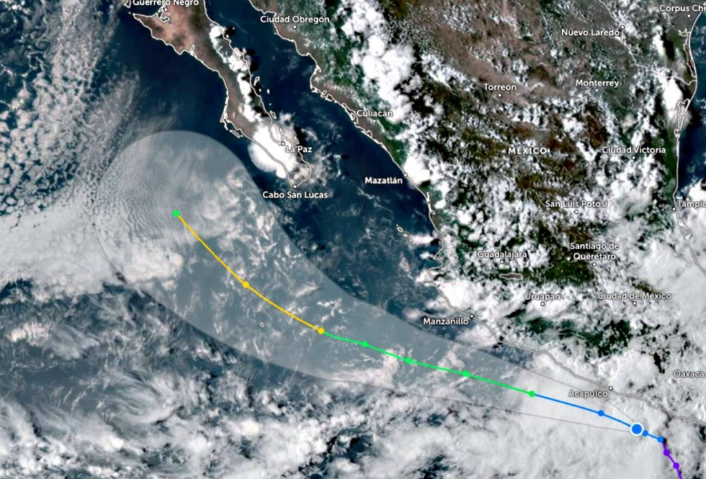
The National Meteorological Service (SMN) reported this Thursday, September 11, the formation of Tropical Depression Thirteen-E in the Pacific Ocean, located 95 kilometers south-southwest of Punta Maldonado, Guerrero, and 195 kilometers southeast of Acapulco. The phenomenon is moving west-northwest at a speed of 9 km/h (5.6 mph), with a possible approach to Baja California Sur.
With sustained winds of 55 km/h (34 mph) and gusts of up to 75 km/h (46 mph), the broad circulation of this system will cause heavy rains in the states of Oaxaca and Guerrero. It is worth noting that, if it becomes a tropical storm, it would be named Mario.
This rainfall is expected to be accompanied by lightning and possible hail, which could cause flooding, landslides, flooding, and rising river and stream levels.
In addition, high waves of between 2 and 3 meters in height and winds with gusts of up to 60 km/h are expected in coastal areas. The National Meteorological Service (SMN) recommends the population exercise extreme caution, especially in vulnerable areas, and follow the instructions of Civil Protection.
According to the forecast, the system will evolve into a tropical storm in the coming hours and could reach Category 1 hurricane status by Saturday, September 14, when it moves southwest of Cabo Corrientes, Jalisco. It will then move toward Baja California Sur as a tropical storm.
Source: bcsnoticias


