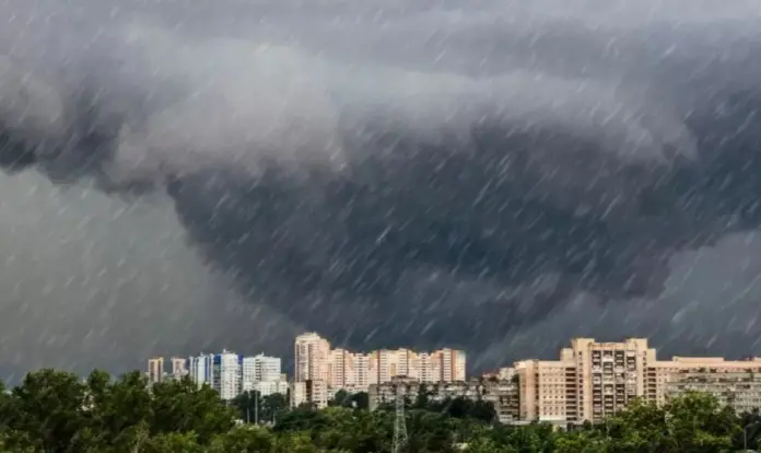
The National Meteorological Service (SMN) updated the weather forecast for Sunday, September 21, warning the public of heavy rain, thunderstorms, and possible hail in several states across Mexico.
The government agency confirmed which states will be affected by the intense rainfall, not only during the day but also at the beginning of the fourth week of the month. Along these lines, it issued a series of recommendations to avoid the damage that inclement weather may cause.
Where will it rain on Sunday, September 21?
Through its official website, the SMN detailed the meteorological phenomena that will affect residents of the Mexican territory on Sunday, September 21.
Today, the Mexican monsoon, combined with atmospheric instability, will maintain conditions for showers and heavy rains in the Baja California Peninsula. The influx of moisture generated by the subtropical jet stream will increase the likelihood of rain in that state. The warning also applies to residents of the states of Sonora, Chihuahua, Durango, Sinaloa, and Nayarit.
At the same time, a low-pressure trough over the northeast and east of Mexico will interact with the influx of moisture from the Gulf of Mexico, increasing the likelihood of showers and heavy rains in those regions and in the north of the country, as well as very heavy rains in Puebla.
On the other hand, a low-pressure area with the likelihood of cyclonic development south of the coasts of Guerrero and Oaxaca, coupled with the proximity of the monsoon trough to the South and Central Pacific of Mexico, will combine with a low-pressure trough over the west and center of the country. These phenomena will generate favorable conditions for showers and heavy rains in these regions, as well as very heavy to intense rainfall in Jalisco, Colima, Michoacán, and Guerrero.
The National Meteorological Service (SMN) is also focusing on southeastern Mexico, where a low-pressure channel will extend into the region, interact with an upper-level trough, and cause intense rainfall in Oaxaca, Veracruz, Chiapas, Tabasco, and Campeche, as well as heavy rainfall in Yucatán and Quintana Roo.
In this context, to keep the public updated, the government agency detailed all the states that could experience rain, accompanied by lightning and possible hail, on Sunday, September 21:
Very heavy rain with intense rainfall (75 to 150 mm)
Guerrero (south)
Oaxaca (east and coast)
Veracruz (south)
Tabasco (west)
Chiapas (north, west, and south)
Campeche (west and southwest)
Heavy rain with very heavy rainfall (50 to 75 mm)
Jalisco
Colima
Michoacán
Puebla
Showers with heavy rainfall (25 to 50 mm)
Baja California
Baja California Sur
Sonora
Chihuahua
Durango
Sinaloa
Nayarit
Morelos
State of Mexico
Mexico City
Yucatán
Quintana Roo
Intervals of showers (5 to 25 mm)
Nuevo León,
Tamaulipas,
San Luis Potosí,
Zacatecas,
Hidalgo, and
Tlaxcala.
Isolated showers (0.1 to 5 mm)
Coahuila
Aguascalientes
Guanajuato
Querétaro.
What warnings has the SMN issued regarding the rains?
The SMN is keeping the general population updated on the inclement weather to which they could be exposed due to various meteorological phenomena.
In this regard, the public entity warned that all forecasted rains will be accompanied by lightning and possible hail, so it is advisable to take the appropriate precautions.
Along the same lines, he explained that heavy to intense rainfall could reduce visibility on stretches of roads, raise river and stream levels, and cause puddles, landslides, and flooding.
In which Mexican states will it rain starting Monday, September 22?
In addition to the weather forecast for Sunday, September 21, the National Meteorological Service (SMN) announced the regions that will be affected by rainfall starting Monday, September 22:
Monday, September 22
Very heavy rain with intense rainfall (75 to 150 mm): Jalisco (west), Colima (coast), Michoacán (west), Guerrero (coast), Oaxaca (coast and east), Chiapas (coast and east), Veracruz (south), and Tabasco (north).
Heavy rain with very heavy rainfall (50 to 75 mm): Nayarit, Puebla, and Campeche.
Showers with heavy rainfall (25 to 50 mm): Sonora, Chihuahua, Durango, Sinaloa, State of Mexico, Mexico City, Morelos, Puebla, Yucatán, and Quintana Roo.
Intervals of showers (5 to 25 mm): Baja California, Baja California Sur, Coahuila, Nuevo León, Tamaulipas, San Luis Potosí, and Tlaxcala.
Isolated showers (0.1 to 5 mm): Zacatecas, Guanajuato, Hidalgo, and Querétaro.
Tuesday, September 23
Very heavy rain with occasional intense rainfall (75 to 150 mm): Oaxaca (west and east), Veracruz (south), and Chiapas (west and south).
Heavy rain with occasional very heavy rainfall (50 to 75 mm): Nayarit, Jalisco, Colima, Michoacán, Puebla, Guerrero (coast), Campeche, Yucatán, and Quintana Roo.
Showers with occasional heavy rainfall (25 to 50 mm): Chihuahua, Sonora, Sinaloa, Durango, State of Mexico, Morelos, Puebla, and Tabasco.
Intervals of showers (5 to 25 mm): Baja California, Baja California Sur, Nuevo León, Tamaulipas, San Luis Potosí, Mexico City, Tlaxcala, Querétaro, and Hidalgo.
Isolated showers (0.1 to 5 mm): Coahuila, Zacatecas, and Guanajuato.
Wednesday, September 24
Very heavy rain with intense rainfall (75 to 150 mm): Jalisco (west), Colima, Michoacán (west), Oaxaca (east), Veracruz (south), and Chiapas (west, east, and south).
Heavy rain with very heavy rainfall (50 to 75 mm): Sinaloa, Nayarit, Guanajuato, Morelos, Puebla, Guerrero (coast), Campeche, Yucatán, and Quintana Roo.
Showers with occasional heavy rain (25 to 50 mm): Baja California Sur, Sonora, Chihuahua, Durango, Coahuila, Nuevo León, Tamaulipas, San Luis Potosí, Querétaro, Hidalgo, State of Mexico, Mexico City, and Tlaxcala.
Intervals of showers (5 to 25 mm): Zacatecas and Aguascalientes.
Scattered showers (0.1 to 5 mm): Baja California.

Source: cronista


