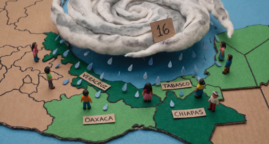

Tropical Wave No. 16 will continue moving across Mexico on Tuesday, July 7, and, in combination with two upper-level cyclonic circulations, a trough, a low-pressure channel, and moisture from both coastlines, will generate heavy rainfall across southern and southeastern Mexico, along with strong to very heavy precipitation over much of the country, according to the National Meteorological Service (SMN).
The agency, part of the National Water Commission (Conagua), explained that the interaction of these weather systems will maintain unstable atmospheric conditions throughout the day, favoring thunderstorms with lightning, possible hail, strong wind gusts, and elevated waves along both coastlines. The heaviest rainfall could also trigger landslides, river overflows, flooding, and water accumulation in several states.
Authorities urged the public to stay informed through official SMN, Conagua, and Civil Protection channels, as weather conditions could change rapidly throughout the day.
Tropical Wave No. 16 and Two Cyclonic Circulations Will Intensify Rainfall
The primary weather system on Tuesday will be Tropical Wave No. 16, which will interact with two upper-level cyclonic circulations—one located over the western Gulf of Mexico and another off the western coast of Baja California Sur.
These systems will combine with a trough extending from southeastern to eastern Mexico, a low-pressure channel over the Mesa del Norte, atmospheric instability, moisture from the Pacific Ocean, and a mid-level anticyclonic circulation. Together, these features will produce widespread rainfall across much of the country.
According to the SMN, the greatest rainfall activity will occur in southern and southeastern Mexico, where Tropical Wave No. 16 will encounter favorable conditions for stronger precipitation.
Veracruz, Tabasco, Oaxaca, and Chiapas Expected to Receive the Heaviest Rain
The official forecast calls for intense rainfall (75–150 mm) in:
- Veracruz (central and southern regions)
- Tabasco (western region)
- Oaxaca (northern and northeastern regions)
- Chiapas (northwestern region)
Very heavy rainfall (50–75 mm) is expected in:
- Sonora
- Sinaloa
- Chihuahua
- Nayarit
- Jalisco
- Colima
- Michoacán
- Guerrero
Heavy rainfall (25–50 mm) is forecast for:
- Coahuila
- Nuevo León
- Durango
- Zacatecas
- San Luis Potosí
- Tamaulipas
- Guanajuato
- Querétaro
- Hidalgo
- Puebla
- Morelos
- State of Mexico
- Mexico City
- Campeche
- Yucatán
- Quintana Roo
Meanwhile, Baja California Sur, Aguascalientes, and Tlaxcala are expected to experience scattered showers.
The National Meteorological Service warned that the heaviest rainfall could cause landslides, rising river and stream levels, overflows, and flooding in low-lying areas, urging residents to take precautions.
Heavy Afternoon Rain Expected in Mexico City
For Mexico City, the forecast includes heavy rain during the afternoon and evening, accompanied by lightning.
The State of Mexico is also expected to receive heavy rainfall, particularly in its central and western regions.
Authorities advised residents to prepare for possible traffic disruptions caused by flooding, reduced visibility, and heavy congestion during storms.
Heat Wave to Continue in Northwestern Mexico
Despite widespread rainfall, the SMN reported that very hot to extremely hot conditions will continue across northwestern Mexico.
The heat wave will persist in:
- Baja California Sur
- Sonora
Forecast maximum temperatures:
Above 45°C
- Baja California
- Sonora
40°C to 45°C
- Baja California Sur
- Sinaloa
- Chihuahua
- Nuevo León
- Tamaulipas
- Michoacán
35°C to 40°C
- Coahuila
- Durango
- Nayarit
- Jalisco
- Colima
- Morelos
- Puebla
- Guerrero
- Oaxaca
- Chiapas
- Veracruz
- Tabasco
- Campeche
- Yucatán
- Quintana Roo
Given these conditions, Conagua recommended staying well hydrated, wearing light-colored clothing, avoiding prolonged exposure to the sun, and paying special attention to children and older adults.
Strong Winds and Elevated Waves Expected Along Both Coastlines
In addition to the rainfall, the SMN forecasts sustained winds of 30–40 km/h, with gusts of 50–70 km/h in Sonora, as well as southerly wind events (suradas) in Coahuila, Nuevo León, and Tamaulipas.
Wind gusts of 40–60 km/h are also expected in:
- Baja California
- Baja California Sur
- Sinaloa
- Chihuahua
- Durango
- Zacatecas
- San Luis Potosí
- Querétaro
- Puebla
- Guerrero
- Oaxaca (Isthmus of Tehuantepec)
- Chiapas
- Tabasco
- Campeche
- Yucatán
- Quintana Roo
Along Mexico’s coastlines, long-period swell (mar de fondo) will continue, producing waves of 1 to 2 meters along the western coast of the Baja California Peninsula, as well as the coasts of:
- Sinaloa
- Nayarit
- Jalisco
- Colima
- Michoacán
- Guerrero
- Oaxaca
- Chiapas
Similar wave heights are also expected along the coasts of Yucatán and Quintana Roo.
The National Meteorological Service reiterated its call for the public to stay informed through official Conagua channels and follow Civil Protection recommendations, as the interaction between Tropical Wave No. 16 and the upper-level cyclonic circulations will continue producing widespread rainfall and hazardous weather conditions across much of Mexico throughout Tuesday.
Source: infobae