
Mexico Could Face an Unprecedented El Niño, With Extreme Heat and Increased Cyclone Activity
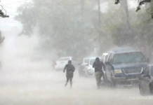
The National Meteorological Service (SMN) warned that projections for the coming months indicate that Mexico will face an unprecedented El Niño phenomenon. The most noticeable effects are expected beginning next September, as intense cyclonic activity is forecast in the Pacific Ocean, followed by extreme temperature events through next year.
“We are seeing an El Niño that has no precedent in the projections we are looking at; however, we must be very prepared. It will affect the entire summer, winter, autumn, and spring of next year. The scenarios are extreme in the sense that we could experience many heat waves throughout next year,” warned Fabián Vázquez Romana, general coordinator of the SMN.
In an interview with MILENIO, following the seminar “El Niño 2026: The Link to the Global Climate Emergency, What to Expect and How to Prepare,” organized by the Mexican Climate Initiative (ICM) in partnership with the UNAM Climate Change Research Program, the head of the Meteorological Service agreed with researchers from the UNAM Institute of Atmospheric Sciences and Climate Change, Jorge Zavala and Francisco Estrada, in forecasting that 2027 will be the hottest year in Mexico, with temperatures that could “exceed the limits of human tolerance.”
“It could be a very complicated situation. We must remember that heat waves are the meteorological or climatic events that cause the most deaths worldwide. It is a very silent issue, yet it has a tremendous impact on society.”
The Master of Science emphasized that extreme temperatures have multiple effects, affecting agriculture, thermal comfort, health, and energy efficiency, while not all regions of the country are prepared for such events.
“We have to be aware that not everyone is adapted to the types of temperatures that may occur. Remembering 2024, which was the hottest year, all temperature records were broken, and it is very likely that the following year we will once again break all temperature records. So, this is a clear warning of what we could experience next spring,” he said.
Likewise, Fabián Vázquez highlighted that intense cyclonic activity is expected in the Pacific Ocean beginning in September. Activity has already been high, although the cyclones have formed far from the coast.
“A lot of cyclonic activity is expected this season in the Pacific Ocean because we have seen that sea surface temperatures are very high and the trade winds are very weak. Many have formed; we are already at the letter H, with Hernan. What has happened? They have all been very far from the coast. Only Boris has affected us, while all the others have remained far away, and the Atlantic is completely calm,” he explained.
He added that conditions involving winds in the Caribbean Sea and Saharan dust, which has been particularly active, have contributed to the low number of tropical cyclones in the Atlantic, with only three systems having formed.
“September is the most active month; it is the peak of cyclonic activity, especially in the Atlantic Ocean during the first ten days of September. I would expect us to see more activity. At the moment, I do not think anything in the Caribbean Sea is likely because conditions are very unfavorable for cyclone formation. However, I believe the Atlantic and the Gulf of Mexico need to be monitored closely, particularly the Gulf, which is already very close to our coast.”
“Climatologically, in October, cyclones also tend to approach Baja California Sur from the Pacific side. Therefore, the season is not over; it remains active. We have been fortunate in the sense that they have remained far from the coast, but that does not mean they cannot affect us during September and October,” he emphasized
Source: msn