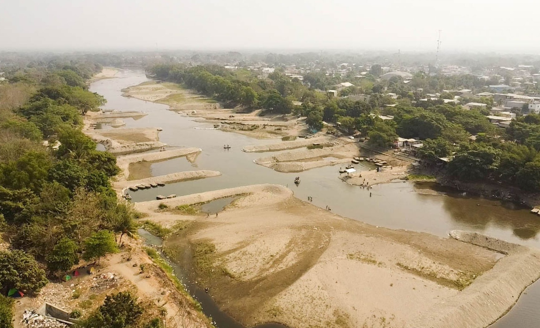

Flooding and a lack of investment in infrastructure have put Mexico at risk of losing approximately 5,000 hectares of national territory along the southern border with Guatemala. This is equivalent to 6.7 times the size of Mexico City International Airport, which has a total surface area of 746.43 hectares.
According to official documents obtained by EMEEQUIS, the Mexican government has a project to mitigate the loss of national territory along 19 kilometers of the right bank of the Suchiate River. However, work has only been carried out along 5 kilometers, despite the project being considered a matter of national security.
In addition to the loss of national territory caused by the Suchiate River changing course, flooding also affects populated areas of the Soconusco region and agricultural production.
“Recently, in June 2024, intense rainfall caused the Suchiate River to overflow, affecting approximately 50 homes and businesses in Ciudad Hidalgo, with water reaching up to half a meter inside the properties. In response, the Chiapas government declared a state of emergency in Suchiate, primarily because of the threat to crops. The consequences of these floods were as follows: Territorial loss; it is estimated that between 800 and more than 5,000 hectares of national land have ended up on the Guatemalan side due to the diversion of the river’s course,” acknowledges the National Water Commission (CONAGUA).

It also acknowledges that there is insufficient infrastructure to guarantee the protection, safety, and lives of more than 41,000 inhabitants.
“The current situation in the region reveals critical deficiencies in flood protection and comprehensive disaster management, which not only compromise the life and health of the population and the integrity of the environment, but also limit economic development and urban resilience in the face of natural phenomena,” the document states.
LOSS OF TERRITORY
In 2005, the remnants of Hurricane Stan caused severe flooding in the Barrio Nuevo neighborhood of Ciudad Hidalgo, Suchiate, affecting approximately 350 families. The event not only caused the river to overflow but also resulted in a significant change in its course, leading to the loss of Mexican territory.
In 2010, heavy rains from Hurricane Alex caused new flooding in Ciudad Hidalgo. In 2011, Tropical Wave Number 8 generated flooding in Ciudad Hidalgo.
And in June 2024, heavy rainfall led authorities to declare a “state of emergency” and resulted in the territorial loss of between 800 and more than 5,000 hectares that ended up on the Guatemalan side.
In 2019, the “project to protect the population, productive areas, and infrastructure against flooding and mitigate the loss of national territory along the 19-kilometer right bank of the Suchiate River, from the San Antonio neighborhood to its mouth at the sea, in the state of Chiapas” was approved. An investment of 2.556 billion pesos was estimated over 10 years.

The project was rescheduled and reprogrammed for the 2023–2025 period, but no longer covered the entire 19 kilometers, instead being reduced to a maximum of 5 kilometers.
Mexico already had a history of losing national territory due to flooding caused by the Suchiate River overflowing.
“The change in the course of the Suchiate River has historically caused the loss of sovereignty over Mexican territory, which has elevated the project to a category of public interest and national security, with the involvement of the Ministry of Environment and Natural Resources (Semarnat) and the International Boundary and Water Commission,” CONAGUA explains.
Protective infrastructure needs to be built along the 19-kilometer stretch of the Suchiate River to protect the population, safeguarding communities and communal lands located along the riverbanks from the constant flooding that occurs during the rainy season. The infrastructure would also protect public and private facilities, as well as agricultural areas in the region—particularly banana crops, which are a pillar of the local economy—and, above all, mitigate the loss of national territory by halting erosion along the river’s right bank.
“The project needs to be updated, focusing on infrastructure works and complementary measures through social networks. The main goal includes constructing a 19-kilometer Protective Embankment, of which 14.25 kilometers remain to be built along the river’s right bank, as well as constructing 47 rock-fill groynes and carrying out supervision,” CONAGUA details.
In 2020, 2.23 kilometers of embankment were constructed; in 2022, another 1.6 kilometers were completed; and in 2025, only 925 meters were built.
It is estimated that more than 41,000 inhabitants of the region are at risk because of the lack of this infrastructure, in addition to hundreds of hectares of farmland.
The government of President Claudia Sheinbaum estimates that the project will help recover national territory, “whose loss is caused by the river’s meandering; the damage avoided is intangible but related to national security.”
“Failure to carry out the project would deepen the existing problems, with irreversible consequences in terms of pollution, public health, and deterioration of quality of life, but above all, it would allow the continued loss of national territory due to changes in the course of the Suchiate River,” CONAGUA states.
Thus, the governments of the so-called Fourth Transformation and President Claudia Sheinbaum have allowed the loss of national territory to Guatemala due to the lack of continuity and investment in hydraulic infrastructure along the Suchiate River, while above all continuing to put the lives of residents of Ciudad Hidalgo and Suchiate, Chiapas, at risk.

Source: emeequis