

Nothing is crazier than waking up on a Sunday and knowing that there was an earthquake in Mexico. It happened in Chiapas, on the border with Guatemala, and there are several photos and videos that show that it was not just anything.
6.2 magnitude earthquake on the border between Chiapas and Guatemala
As reported by the National Seismological Service in a statement, the earthquake was specifically recorded 76 km southwest of Ciudad Hidalgo, at 05:39 in the morning of this Sunday, May 12.
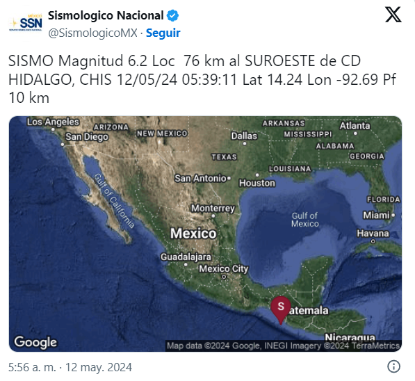
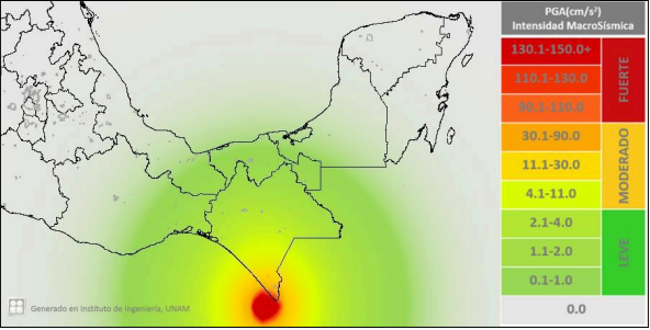
The epicenter of this strong earthquake was very close to Tapachula, so the movement was perceived with great intensity by the inhabitants of the region.
“Chiapas is one of the states with the highest seismicity in the Mexican Republic. The origin of this seismicity is due to the convergent contact between important tectonic plates: The Cocos plate and the North American Plate, and in the southern part of the state of Chiapas, the contact is between the Cocos plate and the Caribbean plate. The interaction between these plates takes place on the Pacific coast, in front of said state.”
Photos and videos of how the earthquake was experienced in Chiapas and Guatemala
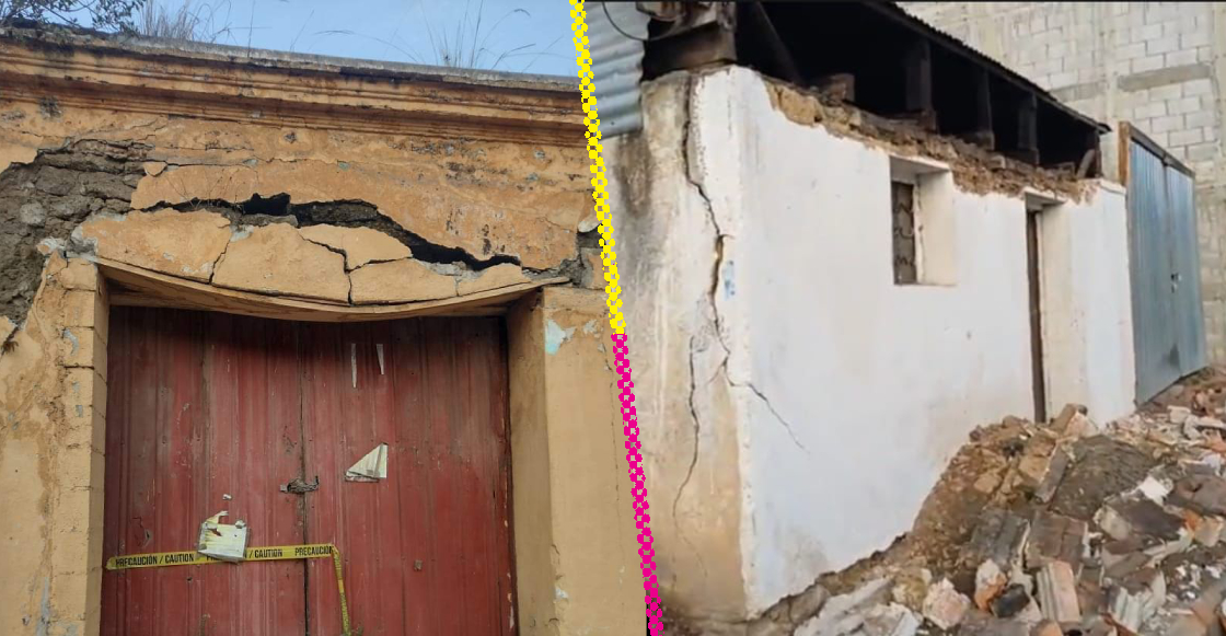
Fortunately, authorities have reported no human losses after the 6.2 magnitude earthquake. However, structural damage has been reported, mainly in San Marcos and Quetzaltenango, communities in Guatemala.
And there were worrying cracks in buildings and homes, in addition to a couple of collapses and landslides. In Chiapas, so far, these situations have not been reported.
As we said at the beginning, the photos and videos that have been shared after the earthquake that occurred on May 12 prove that it was not just another one. Solidarity from here for all the people affected.

Source: Sopitas


