There are 3 phases to a greater or lesser extent of “El Niño – Southern Oscillation” or better known as ENSO: we have the neutral phase where the sea temperatures of the equatorial Pacific are within their average value generating variable weather typical in various regions of the world.
When the sea warms up, with anomalies greater than 0.5 °C of thermal anomaly, it is known as “El Niño” and can be the most feared, because it is 100% related to a record heat event worldwide and, eventually, extends drought with large forest fires, what happens when the sea cools down?
La Niña, our savior against El Niño
When the waters of the equatorial Pacific cool down with anomalies below -0.5 °C, we speak of the La Niña phenomenon, an event that is generally associated with a global cooling or, at least, slows the rise in temperatures causing summers with excessive heat and more extreme winters with Arctic/Antarctic temperatures.
We could say that this is the total counterpart of El Niño and compared to it, La Niña compensates for its effects. Relative to the region and time of year, these phenomena are beneficial and harmful since both generate rain, floods, drought, heat and cold throughout the world.
Normally, La Niña has a longer duration, sometimes several years, but with less intensity than El Niño, which rarely lasts more than 1 year; it commonly appears in summer and dissipates in the following spring. In contrast, the neutral phase does not observe any specific or unique effects or durations.
What can happen in the next few weeks?
The atmospheric response to ocean conditions is not immediate, and when some ENSO phase is established it can take a couple of weeks to be evident at least globally, since locally, where the winds and sea temperature in the Pacific have changed, it can be observed immediately.
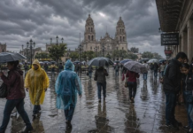
Currently, we are in a neutral phase, which was enough for Mexico to normalize circulation and have a rainier weather, according to the season; if we are in a neutral phase in winter, the cold could be typical, in spring we could have mild heat and storms with hail, and in summer the rains would normalize.
Forecast of accumulated rainfall in millimeters
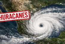
During October, the rains and threat of cyclones will continue, gradually giving way to the cold masses typical of La Niña.
We are experiencing this and even more so, thanks to the fact that we are in transition to La Niña, increasing the rains at this time, just as we experienced in September and it may even occur part of this October when there would be a combination of rains and floods with dry, windy and cold periods. It is likely that La Niña will become official this October.
La Niña and winter
As we enter October and November, the Pacific jet stream begins to curve towards the Gulf of Alaska, forming an anticyclone with a polar trough from the Arctic towards Canada and the United States, with its most notable effects from December to February, in the middle of winter.
La Niña cold periods
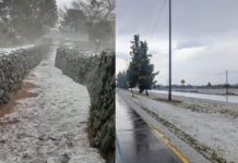
Although, on average, the winter of La Niña is not cold, Arctic masses with extreme temperatures of up to -20 °C or less can reach Mexico for periods with snowfall, frost and frost.
The Arctic, North Atlantic and East Pacific oscillations tend to occur for very negative periods, implying greater pressure in polar areas and allowing, together with the current, all that extreme cold to drop in latitude and reach Mexico; however, while that is being generated, mild periods of heat may be dominating us.
This limits rainfall mainly in the northern states, due to the position of the current towards Alaska, contrary to El Niño when it is located over our country with eventual rainfall in the central-southern half, but not very abundant. Being drier and with extreme temperatures, these cold periods are typical of extreme frosts and extensive frosts.
La Niña in winter is characterized by being drier than usual, when drought can appear and strengthen, while temperatures are extreme with periods of heat and cold, the latter being very extreme with frost and intense snowfall.
Curiously, statistics show that these extreme events coincide mainly on 2 dates: between December 20 and 25 and between February 12 and 18, very Christmassy and loving La Niña seems to be, when there can be extreme frost, abundant snowfall, North winds exceeding 100 km/h in the Gulf of Mexico and Tehuantepec, as well as rain. Will it be our turn this year 2024-2025?
Source: meteored


