

Zihuatanejo is a high-risk territory due to its geological characteristics and this is stipulated in the Atlas of Risk at the national level.
Due to its geographical location, the state and the municipality are within the so-called zone D considered to be of high seismic activity. Zihuatanejo has soft and rocky terrain.
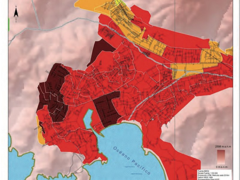
It is located on a map of the municipality, in which the areas with medium and high possibility of damage from earthquakes can be seen. The high risk areas are located in the coastal and mid-mountain region and the medium risk areas are in the high parts of the mountains. The same occurs during the rainy season.
Historically, in Zihuatanejo there have been no deaths of people living in a risk zone. However, several families have been relocated. The recent case was the Linda Vista colony, which burned down in December 2018, which forced the authorities to restructure the colony and several families were relocated.
But, if families know they are at risk, why don’t they move from the areas? The answer is one: the need for housing.
The history of the services provided by Civil Protection in the municipality allows us to determine that it is the eastern area where most landslides occur, such as in the 12 de marzo, Nuevo Amanecer, Ampliación La Joya and Las Joyas colonies, to mention a few, where the population moves to the ground and becomes sensitive.
Source: meganoticias


