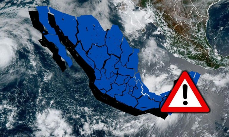

The National Meteorological Service (SMN) of Mexico’s National Water Commission (Conagua) reported that heavy rains will occur across Mexico over the coming hours, due to the Mexican monsoon in the northwest, low-pressure channels interacting with upper-level cyclonic circulations, a mid-level atmospheric trough, and atmospheric instability.
If you live in any of the affected states, authorities recommend staying alert to instructions from local officials and monitoring the latest forecasts issued by the SMN.
Where will it rain in Mexico over the next 48 hours?
The Mexican monsoon in northwestern Mexico, combined with upper-level divergence, will cause very heavy rainfall in parts of Chihuahua and heavy rain in Baja California Sur, Sonora, Durango, and Sinaloa. Showers are also expected in Baja California. These rains may be accompanied by thunderstorms and strong wind gusts.
Meanwhile, low-pressure channels over central Mexico, interacting with an upper-level cyclonic circulation, a mid-level atmospheric trough, atmospheric instability, and the passage of Tropical Wave No. 26 over the Yucatán Peninsula and southeastern Mexico will produce showers and heavy rainfall with thunderstorms across much of the country. Hail is also possible in central and western states.
Intense rainfall is forecast for areas of Jalisco, Colima, Veracruz, Oaxaca, Chiapas, Tabasco, and Campeche, while very heavy rain is expected in Michoacán, Yucatán, and Quintana Roo.
States affected on Wednesday, August 12
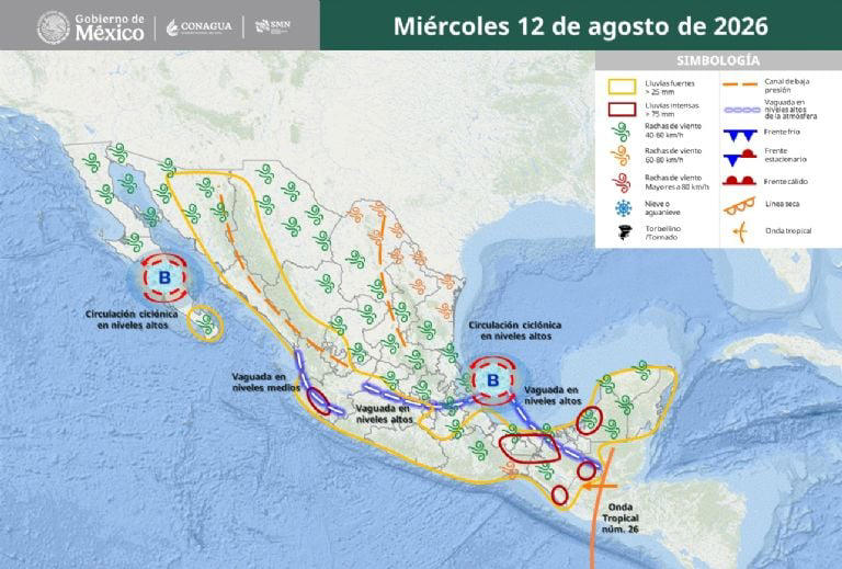
- Very heavy to intense rainfall (75–150 mm): Jalisco (west), Colima, Veracruz (south), Oaxaca (east), Chiapas (north, east, and south), Tabasco (west and south), and Campeche (coast and southwest).
- Heavy to very heavy rainfall (50–75 mm): Chihuahua (southwest), Michoacán (west and north), Yucatán (west), and Quintana Roo (south).
- Showers with locally heavy rainfall (25–50 mm): Baja California Sur (south), Sonora (north and south), Sinaloa (north and central), Durango (northwest and west), Nayarit, Guanajuato (southwest), Hidalgo (southwest), State of Mexico (central and west), Mexico City, Puebla (southeast), and Guerrero (southeast).
- Scattered showers (5–25 mm): Baja California, Tamaulipas, San Luis Potosí, Zacatecas, Aguascalientes, Querétaro, Morelos, and Tlaxcala.
- Isolated rainfall (0.1–5 mm): Coahuila and Nuevo León.
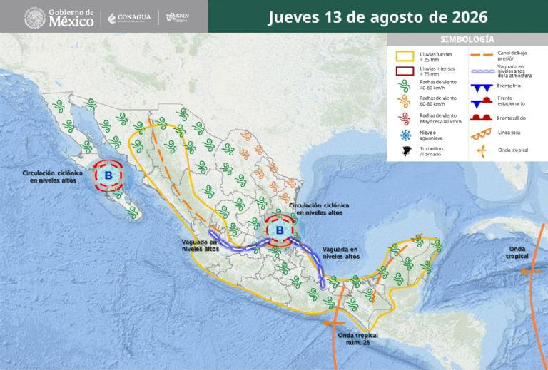
States expecting rainfall on Thursday, August 13
- Heavy to very heavy rainfall (50–75 mm): Jalisco (west and east), Guanajuato (southwest, south, and southeast), State of Mexico (north and central), Guerrero (north and east), Oaxaca (west), and Chiapas (central and west).
- Showers with locally heavy rainfall (25–50 mm): Sonora (east), Chihuahua (west and southwest), Durango (west and northwest), Sinaloa (central and south), Nayarit, Colima, Michoacán (north and east), Tamaulipas (south), San Luis Potosí (east), Querétaro (west and central), Hidalgo (central, west, and south), Mexico City, Morelos, Tlaxcala, Puebla (east and southeast), Veracruz (central and south), Tabasco (west and south), Campeche (north and southwest), Yucatán (south and west), and Quintana Roo (central).
- Scattered showers (5–25 mm): Baja California Sur, Coahuila, Nuevo León, Zacatecas, and Aguascalientes.
- Isolated rainfall (0.1–5 mm): Baja California.
What is the rainfall outlook for Friday, August 14?
The Mexican monsoon in northwestern Mexico, low-pressure channels, cyclonic circulations, and mid- and upper-level atmospheric troughs across the country, combined with upper-level divergence and the passage of Tropical Wave No. 26 through southeastern, southern, and western Mexico, will maintain the possibility of showers and heavy to very heavy rainfall accompanied by thunderstorms across much of the country.
Hail may occur in western and central states. Intense rainfall is forecast for Sonora, Chihuahua, and Guerrero.
A new tropical wave will approach and move across the Yucatán Peninsula and southeastern Mexico, increasing the probability of rainfall in those regions.
- Very heavy to intense rainfall (75–150 mm): Sonora (east and southeast), Chihuahua (west and southwest), and Guerrero (south and east).
- Heavy to very heavy rainfall (50–75 mm): Durango (northwest and west), Sinaloa (central), Nayarit (central and east), San Luis Potosí (east), Querétaro (south), Hidalgo (southwest and west), State of Mexico (north), Tlaxcala, Puebla (north), and Veracruz (north and south).
- Showers with locally heavy rainfall (25–50 mm): Coahuila (south and southeast), Nuevo León (central and south), Tamaulipas (south), Jalisco (west, central, and east), Colima, Michoacán (north, central, and east), Guanajuato (central, south, and southeast), Mexico City, Morelos, Oaxaca (north and west), Chiapas (south and east), Tabasco (west and east), and Campeche (southwest).
- Scattered showers (5–25 mm): Baja California Sur, Zacatecas, Aguascalientes, Yucatán, and Quintana Roo.
- Isolated rainfall (0.1–5 mm): Baja California.
Source: msn